Every project begins long before the design is finalized or construction mobilizes. It begins with certainty.
Surveying is not a preliminary task, it is the foundation that directly influences schedule, cost control, coordination, and long-term performance. At WalterFedy, we continue to invest in and leverage new technology to enhance survey data quality and refine our team’s proprietary capabilities and workflows. This way, our team ensures that data translates to actionable insights – reducing risk, preventing costly rework, and protecting our clients’ project timelines.
Powered by Technology. Amplified by People.
WalterFedy has invested in a new generation of surveying technology, bringing our teams onto a fully integrated platform that enhances accuracy, efficiency, and coordination. This includes:
- Carlson RT4 Handheld Tablets for real-time field visualization and direct CAD integration.
- Carlson BRX7 GPS Units with advanced GNSS access and tilt compensation for dependable, efficient data capture.
- Carlson Total Stations delivering millimeter-level precision for critical layout and verification tasks.
- DJI Matrice 4E Drones offer quick turnaround on high-resolution, geolocated aerial images of site conditions, with identifiable and quantifiable features.
These tools increase efficiency and support tighter construction schedules for our clients. But technology alone does not deliver project certainty.
Our team determines when higher precision is required, how to validate discrepancies, when to escalate issues before they affect downstream coordination and translate field data into clear direction for clients and contractors. 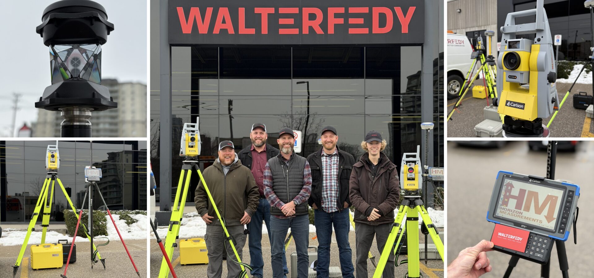
Connected from Field to Office
Technology captures information. Judgment makes it valuable.
Through a connected field-to-office workflow – supported by our integrated Microsoft ecosystem, our survey team validate layouts, assess topographic conditions, and resolve questions in real time. Professional-grade data capture combined with expert CAD workflows allows us to visualize and communicate information quickly and clearly.
The result: reliable, decision-ready information delivered early, reducing risk and protecting schedules.
“The equipment matters, it facilitates how we work, but it’s our people, our workflow, and the seamless connection between field and office that truly define our value. With this new equipment, we’re not just better equipped; we’re a fully capable and fully connected team.” — Brent Golem, Survey Manager
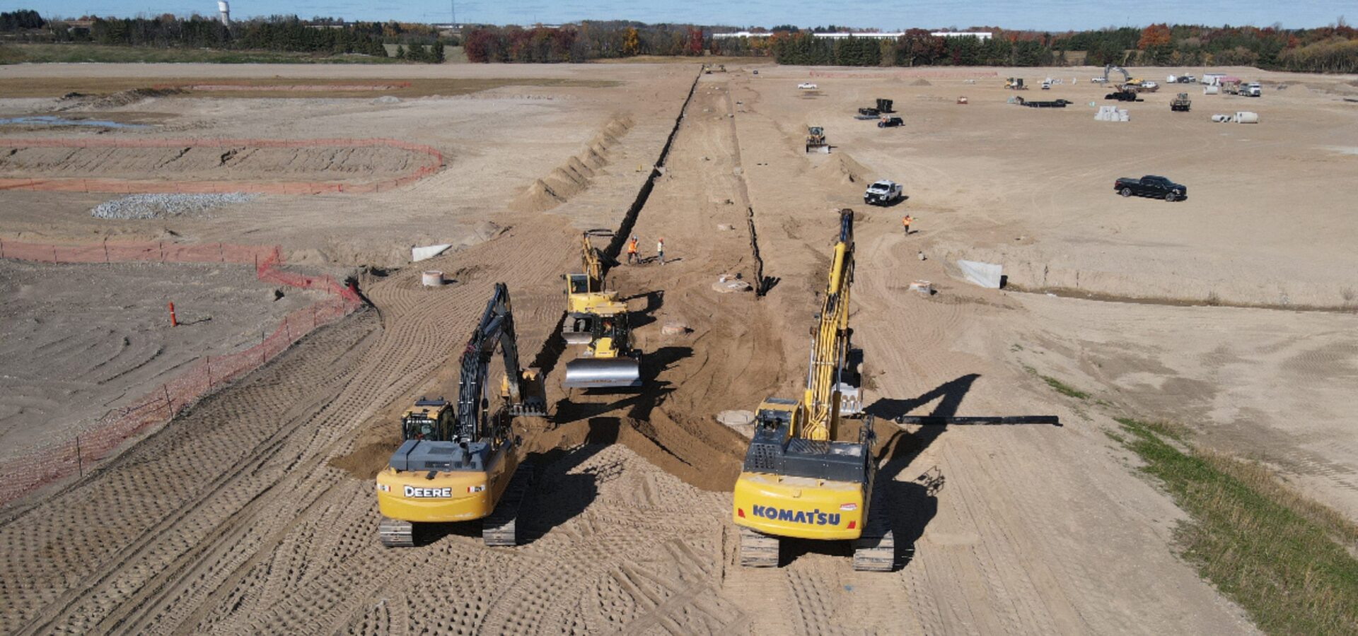
Insight in Action: Bartek’s New $175 Million Production Facility
WalterFedy was engaged as a surveying subconsultant for phased pile layout and As-Built records at Bartek Ingredients’ new $175 million malic and fumaric acid production facility in Stoney Creek, Ontario.
With production capacity set to double, maintaining construction momentum was critical.
During pile layout, our field team identified inconsistencies between CAD coordinates and site conditions. Rather than simply recording the discrepancy, the team investigated and escalated the issue to the design team.
That early intervention enabled corrections before construction progressed further, avoiding significant schedule delays and associated costs.
This is the value of integrated surveying: identifying risk before it becomes disruption.
Surveying Capabilities
- Topographic surveys
- Construction layout and monitoring
- LiDAR scanning and modeling
- Environmental and utility surveys
- Drone surveying and aerial imaging
WalterFedy’s commitment to excellence goes beyond the technical scope. As a fully integrated team of engineers and design professionals, we understand the downstream implications of every measurement taken in the field.
For project surveying inquiries, connect with Brent Golem.